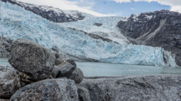
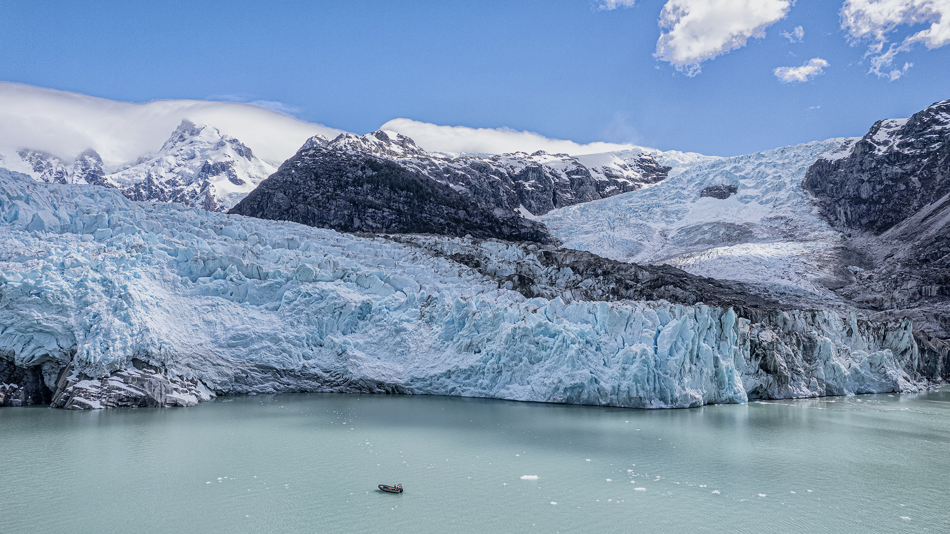
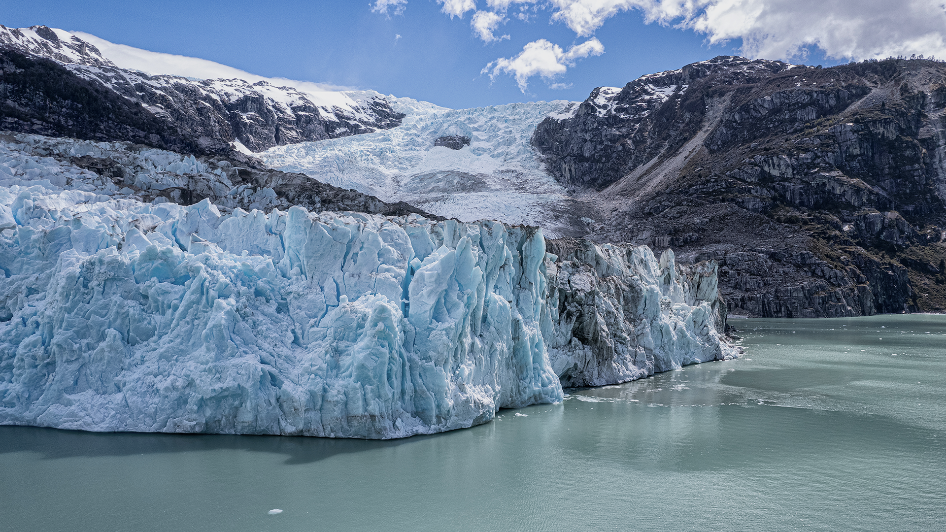
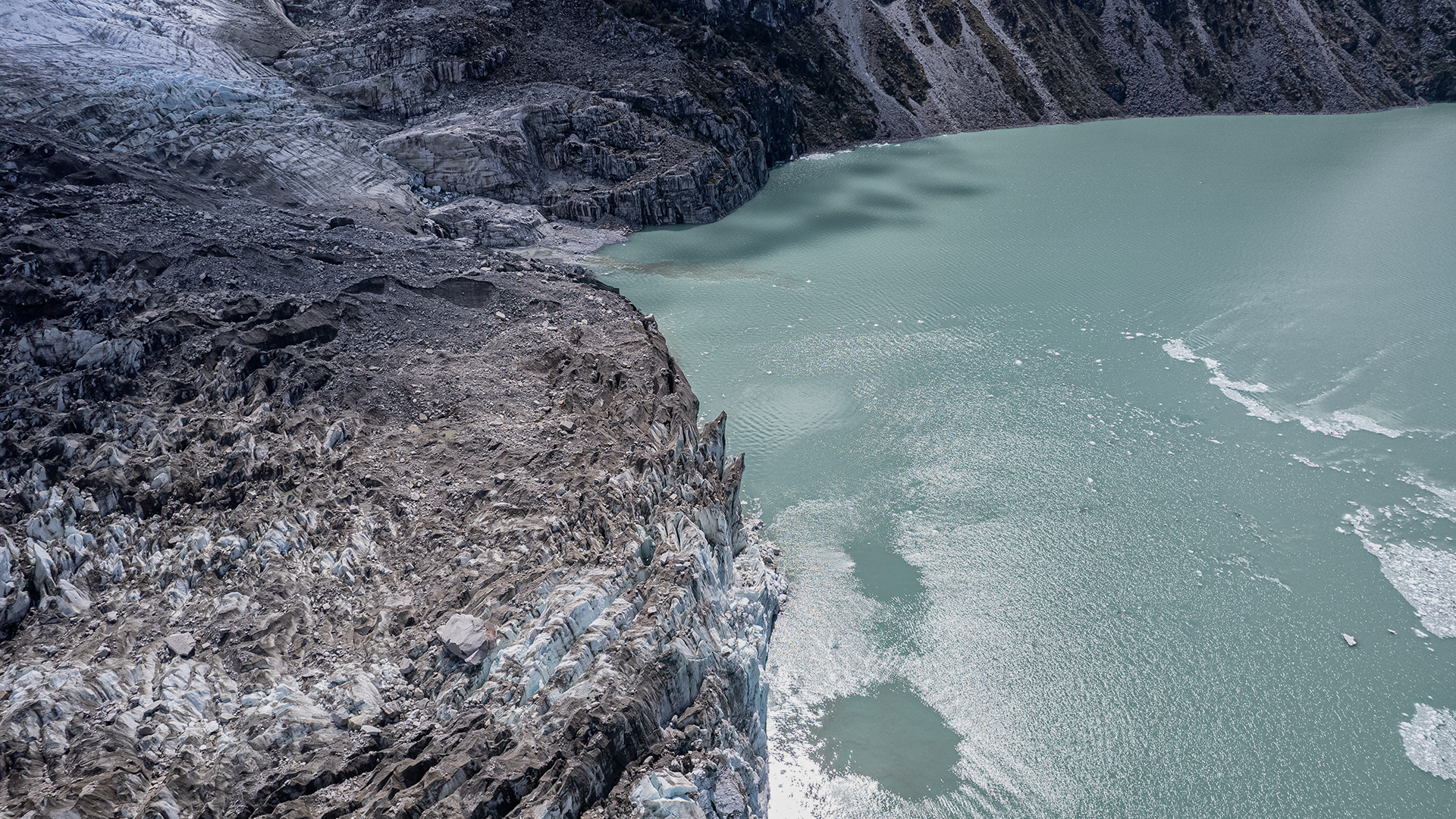
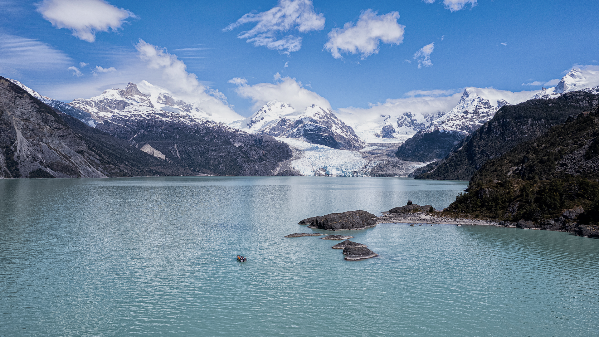
El Glaciar Leones se encuentra ubicado al final del valle que conecta, a través del río del mismo nombre, las aguas del lago Leones con las del lago General Carrera hacia al este, el ventisquero resplandeciente contrasta con las aguas turquesas del lago que alimenta, y se yergue mil metros sobre éste, entre bastiones filudos de granito y los amedrentadores y ampulosos hielos que descienden resquebrajándose desde la gran meseta glaciada del Campo de Hielo Norte.
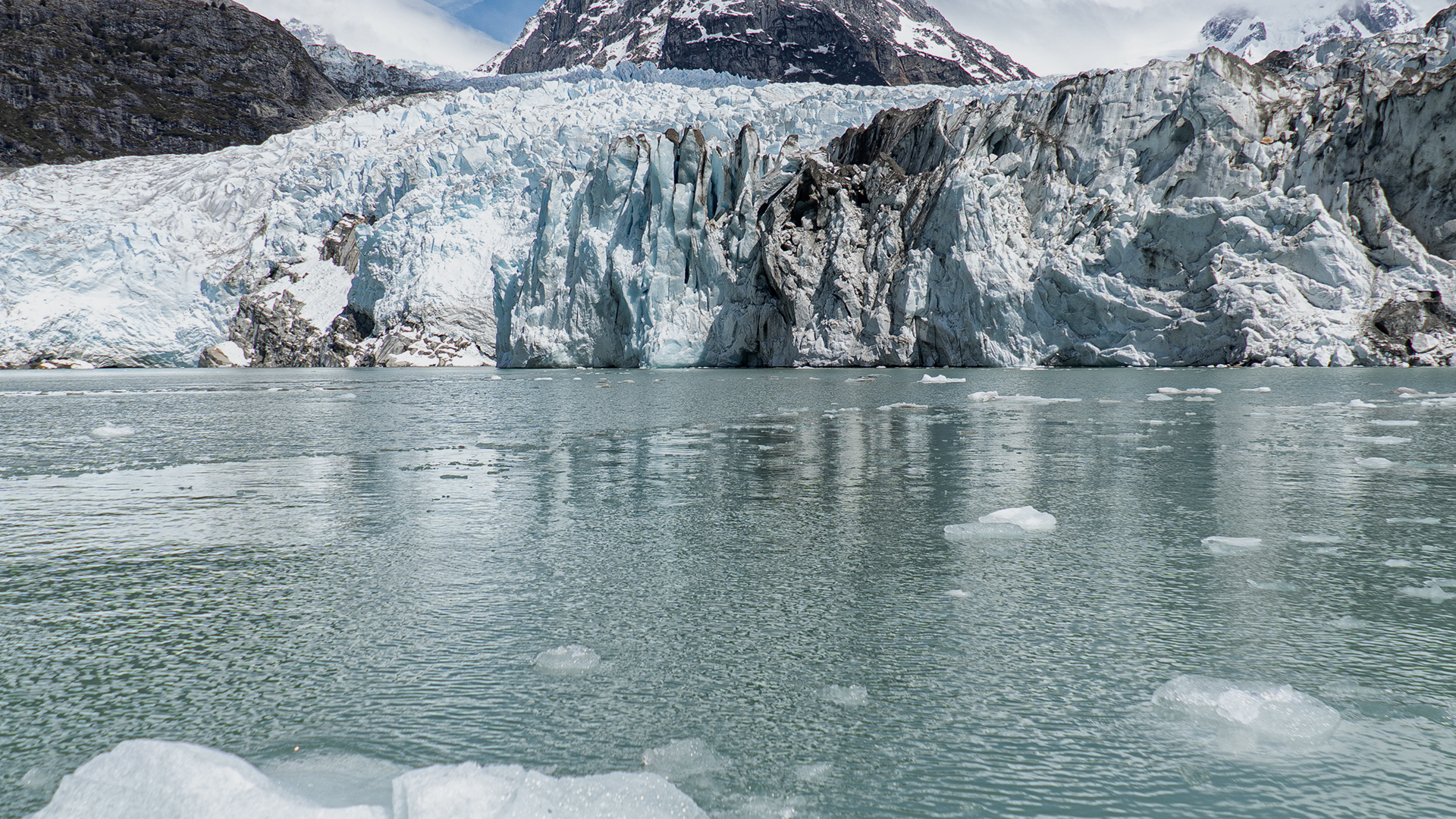
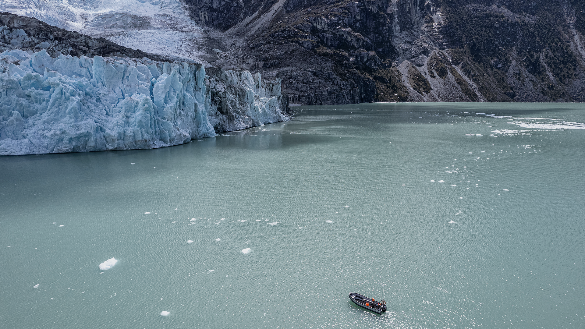
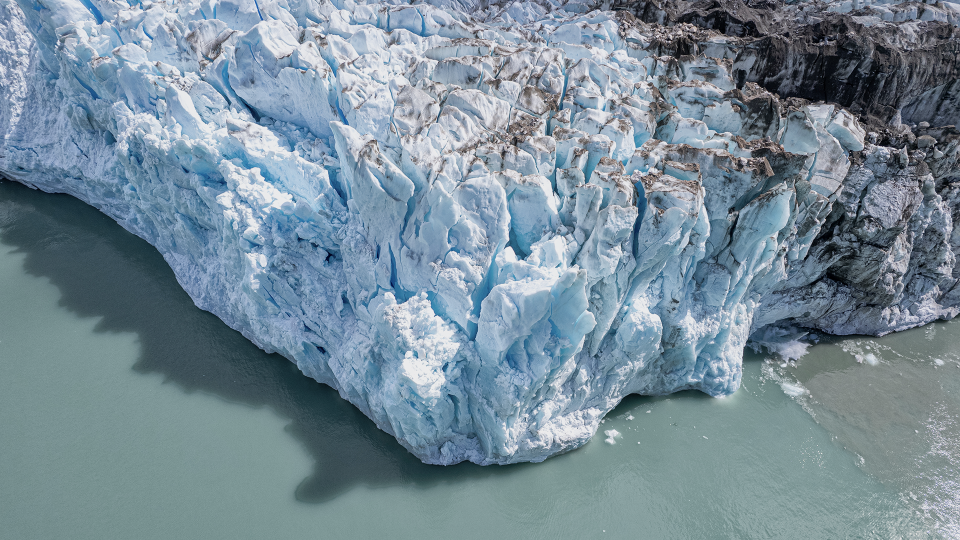
Al abalanzarse sobre las aguas del lago, los pedazos de hielo producen un gran estruendo, que evoca a la distancia, el rugir de una leonera. Si bien esto último podría haber motivado el nombre del glaciar, es más la alta presencia de pumas en la zona, especialmente en el sector más alto del valle, lo que le da el nombre al valle, el lago, el río y sus hielos. El hielo del Leones además se avista recién hacia el final de la aproximación, incrementando el suspenso, la sorpresa y el disfrute del paseo.
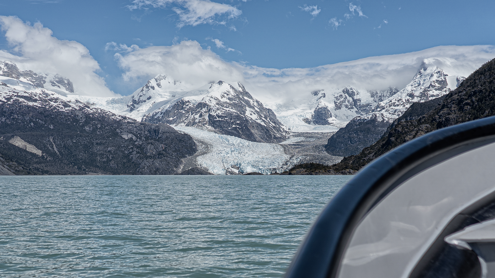
Además de su atractivo principal, el ventisquero, este paseo destaca por combinar la navegación en bote con la marcha a pie; y la contemplación, durante la aproximación, de los meandros del verdoso río Leones con la del tumultuoso desagüe del lago Leones, cuyas aguas son emboscadas a poco andar por las blancas y espumosas aguas del río Fiero que descienden desde el norponiente.
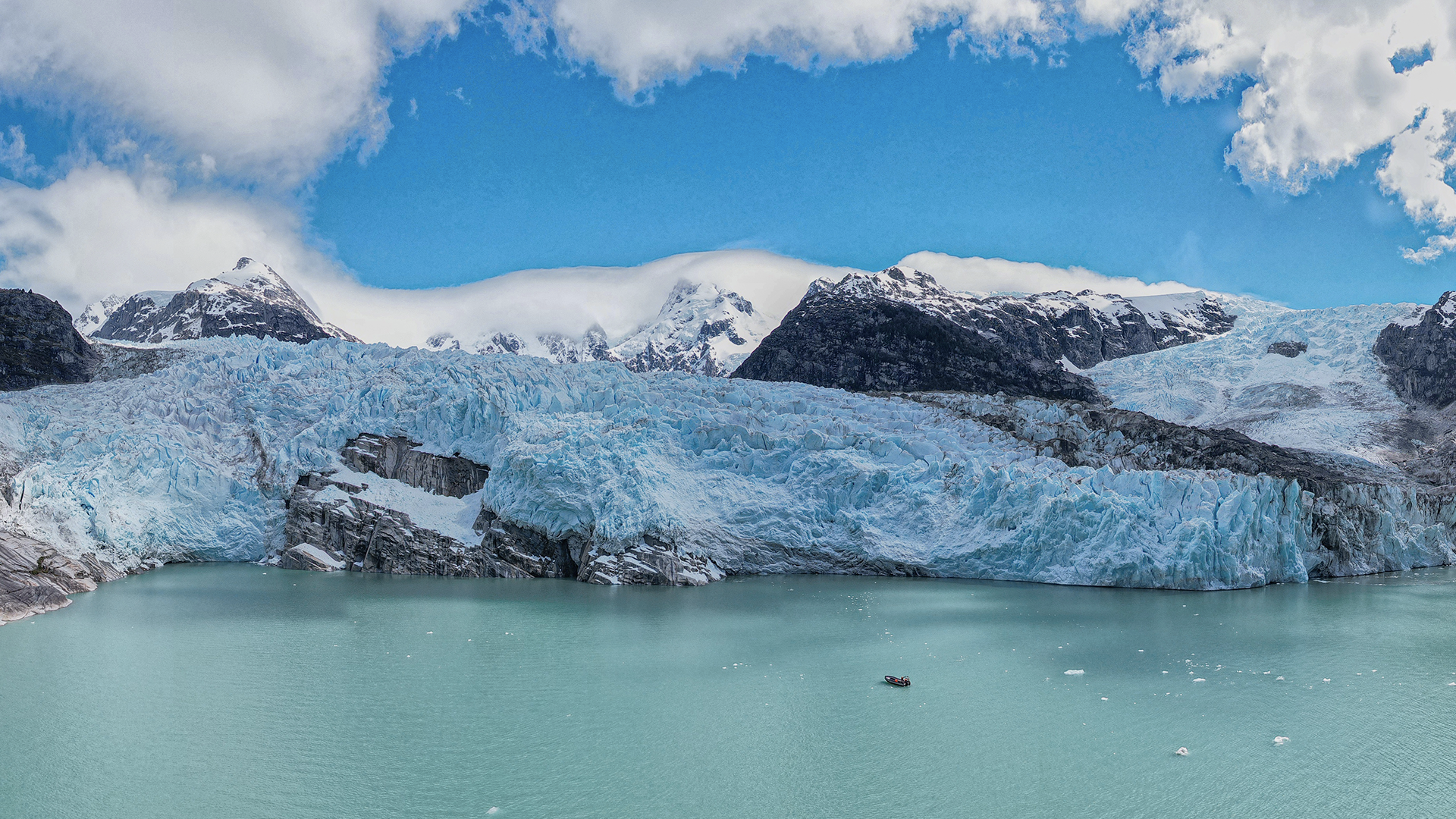
El trayecto al glaciar Leones discurre suave en pendiente (con un desnivel neto acumulado total de apenas 140m, distribuidos uniformemente a lo largo del trayecto) y siguiendo un trazo casi recto a través de un amplio plano sedimentario, antiguo lecho del río homónimo. Con un largo total aproximado de 9km, este se divide claramente en tres tercios, de una hora de duración cada uno: un primer tramo que atraviesa un predio privado, combinando sectores de reforestación, sectores de piedras grandes, pampas y bosque; un segundo tramo que se inicia en el estero El Pedregal, en el límite del siguiente predio hacia el Oeste, atravesando pampas más limosas, bosque, el borde del río Leones, y un tramo corto de pequeñas cuestas; y un tercer segmento que atraviesa un amplio plano pedregoso y más seco, de vegetación más baja y menos densa, que culmina en la orilla oriental del lago Leones.
The Leones Glacier is located at the end of the valley that connects, through the river of the same name, the waters of Lake Leones with those of Lake General Carrera to the east, the resplendent snowdrift contrasts with the turquoise waters of the lake that feeds, and it stands a thousand meters above it, between sharp granite bastions and the intimidating and bombastic ice that descends cracking down from the great glaciated plateau of the Northern Ice Field.
When pouncing on the waters of the lake, the pieces of ice produce a great roar, which evokes in the distance, the roar of a lioness. Although the latter could have motivated the name of the glacier, it is more the high presence of pumas in the area, especially in the highest sector of the valley, which gives the name to the valley, the lake, the river and its ice. The ice of the Leones is also only seen towards the end of the approach, increasing the suspense, surprise and enjoyment of the ride.
In addition to its main attraction, the snowdrift, this tour stands out for combining boat navigation with walking; and the contemplation, during the approach, of the meanders of the greenish river Leones with that of the tumultuous drainage of Lake Leones, whose waters are ambushed shortly after by the white and foamy waters of the Fiero river that descend from the northeast.
The route to the Leones glacier runs gently sloping (with a total accumulated net difference of just 140m, distributed evenly along the route) and following an almost straight line through a wide sedimentary plane, an old bed of the homonymous river. With an approximate total length of 9km, it is clearly divided into three thirds, each lasting one hour: a first section that crosses a private property, combining reforestation sectors, large stone sectors, pampas and forest; a second section that begins in the El Pedregal estuary, at the limit of the next property to the west, crossing more silty pampas, forest, the edge of the Leones River, and a short section of small slopes; and a third segment that crosses a wide stony and drier plane, with lower and less dense vegetation, which culminates in the eastern shore of Lake Leones.